Sep 102010
 

Alex Mitchell continues his historical account of the development of Aberdeen, this week focussing on the old  Castlegate.

no images were found

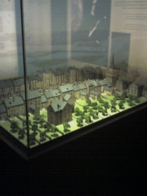
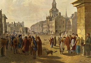
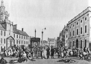
The Castlegate, Broadgate, the Upper and Nether-Kirkgate, Shiprow and Guestrow were once historic and thriving neighbourhoods from the 16th to the 19th centuries.

The old Castlegate was dominated by:

(1) The Tolbooth, dating from 1394, but rebuilt in 1615 and nowadays largely concealed by the frontage of the Town House, built in 1867-72 in Flemish-Gothic style.

(2) The New Inn built by the Freemasons in 1755, visited by James Boswell and Dr. Johnson in 1773. The Freemasons had their Lodge on the top floor, hence the adjacent Lodge Walk. The New Inn was replaced by the North of Scotland Bank, later the Clydesdale Bank, built in 1839-42 as the corner-piece of Castle Street and King Street, and now a pub named after its illustrious architect Archibald Simpson.

(3) Pitfodel’s Lodging of 1530 was the town house of the Menzies family of Pitfodels, a three-storey turreted building, the first private residence in Aberdeen to be built of stone after its predecessor was destroyed by fire in 1529. The Lodging was demolished in 1800 and replaced the following year by the premises of the Aberdeen Banking Company, from 1849 the (Union) Bank of Scotland.

The power and influence of the Menzies family, who were Catholic and Jacobite, was in decline by this time and their old motte-and-bailey castle at Pitfodels, a stone-built tower-house, was in ruins. The associated earthworks were still to be seen at what became the entrance to the Norwood House Hotel until the 1970s, but not much is left there now. The family moved to Maryculter House in the early 17th century. In 1805 John Menzies put the lands of Pitfodels up for sale (also those of Maryculter six years later) and in 1806 purchased 37 Belmont Street (now Lizars opticians). This house had been built in the 1770s and thus pre-dates Belmont Street itself, which was laid down in 1784, well before Union Street.

It is from this house that Mary Queen of Scots is believed to have witnessed the beheading of Sir John Gordon in 1562

In 1831 John Menzies donated his mansion and lands at Blairs to the Catholic Church for use as a college and moved to Edinburgh. He died there without heirs in 1843, the last of the Menzies dynasty, receiving a spectacular Catholic funeral.

Until about 1715 the deceased members of the Menzies family were buried in ‘Menzies Isle’ within St Nicholas Kirk, thereafter in the Kirk-yard. Latterly they were buried at the ‘Snow Kirk’ in Old Aberdeen, just off College Bounds, where the Menzies family grave remains prominent.

(4) Earl Marischal’s Hall dating from about 1540 was next to Pitfodel’s Lodging on the south (harbour) side of the Castlegate. This was the town house of the Keiths of Dunnottar, the Earls Marischal. It had been the Abbot of Deer’s town house but became the property of the (Protestant) Keiths following the Reformation. It consisted of a group of buildings surrounding a central courtyard with gardens attached. It is from this house that Mary Queen of Scots is believed to have witnessed the beheading of Sir John Gordon in 1562 following the defeat of the Gordons of Huntly at the Battle of Corrichie.

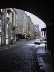
Earl Marischal’s Hall was purchased by the Town Council and demolished in 1767 to allow ‘the opening up of a passage from the Castlegate to the shore (or harbour) and erecting a street there’, that being Marischal Street. Before then there had been no direct route from Castle Street to the Quay, and the growth of trade at the harbour made a new street absolutely necessary. Marischal Street was (and still is) a flyover, possibly the first in Europe, vaulting Virginia Street by means of ‘Bannerman’s Bridge’. It was also the first street in Aberdeen to be paved with squared granite setts, the first street of the new, post-medieval Aberdeen and it is the only complete Georgian street remaining in Aberdeen today.

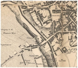
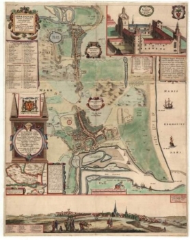
5) Broadgate or Broad Street was the main street of Aberdeen according to Parson Gordon’s map of 1661, lying as it did between the main route north, the Gallowgate and the main (and only) route south via the Green, Windmill Brae and the Hardgate. The old town of Aberdeen never had a High Street as such, probably because St. Katherine’s Hill stood in the way of the most obvious route for a High Street, from the ‘Mither Kirk’ of St. Nicholas to the Castlegate.

A previous resident of Broad Street was the young George Gordon, later Lord Byron. He was born in London in 1788 and was named after his maternal grandfather George Gordon of Gight Castle in Aberdeenshire. The child was brought to Aberdeen in 1790 by his mother Catherine Gordon, after her worthless husband ‘Black Jack’ Byron, had dissipated her inheritance, resulting in Gight Castle being sold to the nearby Gordons of Haddo.

The Castlegate became squalid and dangerous and was notorious for the number and brazenness of the prostitutes

Mother and child lived in lodgings at No.10 Queen Street then moved to No.64 Broad Street. Young George attended the Grammar School at its original location in Schoolhill until 1798, when he inherited his father’s brother’s title and returned to England to continue his education at Harrow, where he was bullied on account of his club foot and Scottish diction.

Castlegate decline

The construction of Union Street from 1801 and the development of the ‘New Town’ westwards of the Denburn encouraged the wealthy and fashionable to migrate in that direction, and the old or medieval town deteriorated throughout the 19th century. The Castlegate became squalid and dangerous and was notorious for the number and brazenness of the prostitutes, who catered for the soldiers in the Barracks and the seamen from the harbour.

The congested old streets and wynds became filthy, infested, stinking and diseased. The courts and closes branching off the Gallowgate were described in 1883 as the dingiest and most unwholesome of any British town. Across the whole Burgh there were still in 1883 some 60 narrow lanes and 168 courts or closes of a breadth of seven feet at most.

The average number of inhabitants per house was reckoned at 14.8 persons. In the St Nicholas Parish the average was 16.8 persons per house. This level of congestion and overcrowding arose because the city’s population was expanding much faster than its geographical boundaries; from 26,992 persons in 1801 to 71,973 in 1851 and to 153,503 in 1901.
Sep 032010
 

Alex Mitchell takes another wander through Aberdeen’s streets for Aberdeen Voice.

Planning Blight: Concerns have been raised about how long the present uncertainty concerning Business Rates and the anticipated chaos attendant on major construction projects will have on business activity in the vicinity of Union Terrace Gardens. Even the relatively small-scale resurfacing work around the Green has seriously disrupted trade & commerce there.

Princes Street in Edinburgh, for example, has been devastated by their Tramways project. The usual effect of ‘planning blight’ is that existing businesses and householders decide to sell up and leave whilst their properties retain some market value, while others who had been thinking of moving in to the affected area – setting up shop, investing in leaseholds etc. – decide not to.

The locality goes downhill as existing proprietors and residents move out and are not replaced by incomers and new entrants. The normal turnover in a healthy property market slows down and grinds to a halt. Property values fall; properties may become effectively unsellable at any price. Basic maintenance, repairs & renewals are neglected as properties come to be regarded by their owners as expensive liabilities rather than as profitable assets worth investing in. The whole area goes into a downward spiral, even if the development proposal never comes to anything.

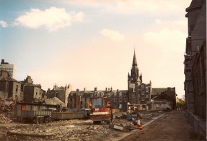
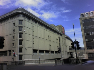
Chaos, Destruction: In her book Lost Aberdeen (2004), Diane Morgan describes the hitherto-vibrant & successful St Nicholas Street/George Street shopping thoroughfare as being reduced to the condition of the Somme battlefield of WW1 for years on end during the 1980s comprehensive redevelopment by a public/private-sector partnership (sounds familiar) between Aberdeen City Council and the developer Bredero.

At that time ACC was in the dubious and compromised position of being both co-developer and the planning authority. All this destruction and the loss of many famous locally-owned stores, for the sake of a pair of undistinguished shopping malls and the questionable amenity of the top deck of the St Nicholas Centre. And George Street has never recovered. Now Fortuna’s Wheel has turned full circle and ACC are about to do it all over again!

The Post Office fronting on to Upperkirkgate has been empty for years. This is pretty much what the proposed City Square on the Gardens could be like, albeit on a much bigger scale.

We checked out the top deck of the St Nicholas Centre recently, on a warm, sunny weekday afternoon. It is exposed to the elements, isolated and cut-off from the mainstream of activity, cluttered with ventilator shafts and was mainly frequented by various unfortunates swigging cider surrounded by empty retail units. Only W H Smith is still in business. The Post Office fronting on to Upperkirkgate has been empty for years. This is pretty much what the proposed City Square on the Gardens could be like, albeit on a much bigger scale.

Bridge Street: Amusing news stories on 30th July 2010 about naked cavortings up on a roof; but there is a wider significance. Bridge Street is a major city-centre thoroughfare, linking Union Street with Guild Street; but the upper floors of the huge granite building in question would seem to be empty, whilst even the ground-floor shop premises, formerly occupied by Jessop’s, are described as being not only empty but in a derelict condition, and a second-floor roof recently collapsed under the weight of a teenage girl.

Much of our city centre is like this – magnificent but largely empty granite buildings, e.g., the Victoria Buildings of 1881 which dominates the westward view along Guild Street, where even the ground-floor premises are either boarded up or in very poor condition. Why is ACC seemingly hell-bent on throwing away public money on a largely unwanted City Square when the basic fabric of our city centre is falling apart all around us?

Saturday 14th August 2010: Sunny and warm. Union Terrace Gardens looking beautiful. Flowering plants like fuchsia and begonias last much longer than in more exposed, windswept and sun-scorched locations. Lots of people, and all the trees appear in vigorous health, contra ACSEF. Up on to Union Street, then Justice Mill Lane.

Decided to walk back along the old road into Aberdeen from the south, via the Hardgate, Windmill Brae and through the Green.

Huge granite buildings loom above the lower reaches of Windmill Brae, e.g., the Royal Hotel on Bath Street, resembling an immense French chateau – also the impressive Venetian Gothic façade of the former Palace Theatre (1898) on Bridge Place. The main thoroughfare of Bridge Street itself was laid down in 1865-7, swooping over the old route in from the south to link Union Street with Aberdeen Joint Station, Guild Street and the Harbour area.

Bridge Street also links with Bridge Place, which stands on a ridge extending from Holburn Street to Crown Terrace. The ridge slopes steeply down to the Harbour, forming a natural amphitheatre, used in medieval times for the staging of various events. Along this ridge were fought the battles of the Craibstane, the Langstane and the Justice Mills.

So this is a topographically and historically complex area. As elsewhere in Aberdeen, the Victorian streetscape of Bridge Street, Bridge Place and Bath Street was superimposed or built on top of the alleys and wynds of the medieval burgh. Windmill Brae effectively goes underground, passing below Bridge Street and terminating at the TrinityCentre car park.

So I turn right and walk along an alley and up some steps and emerge facing the magnificent but ruinous frontage of Ellis & Wilson’s Victoria Buildings of 1881. It is seriously difficult – I take my life in my hands – getting past the entrance to the TrinityCentre car park and the junction with the Denburn By-Pass on the urban motorway of Wapping Street. Thence along Rennie’s Wynd to the Green for a much-needed cup of coffee at Café 52 with Dorothy Bothwell. People walked this route (more-or-less) into Aberdeen for some 600 years before Union Street was built. Now it’s hardly worth trying.

Why should we have to scuttle about underground, in the dark, like half-blind rats in a sewer?

However, in effect, I walked around three sides of the huge TrinityCentre; west, south & east. The trouble is, once you’re on the Wapping Street motorway, there’s no obvious way out! We wonder how much of an older Aberdeen was wrecked to create this urban nightmare – truly the road to nowhere.

But we are told that one can walk directly from the foot of Windmill Brae through the lower level of the TrinityCentre car park. A pedestrian walkway follows the path across the one-time Bow Brig and emerges on to the Green. Ho-hum. I must admit I have never set foot in the Trinity Shopping Centre, nor its multi-storey car park. I don’t think we should have to, either, to get around our own town. The car park is described as “dark and dingy (aren’t they all?) especially at the Green end”. These places give me the horrors, even on a bright sunny day – urban-nightmare-in-daytime territory. Why should we have to scuttle about underground, in the dark, like half-blind rats in a sewer?

About the only positive here is the return of the place-name ‘Trinity’. When the former Trinity Shopping Centre was bought over by the group calling itself simply ‘The Mall’ in 2006, they rebranded the place as ‘The Mall, Aberdeen’, resulting in predictable confusion with all the other shopping malls in Aberdeen. They had in the process thrown away the medieval place-name ‘Trinity’, which goes back some 800 years on this site to the Trinitarian or ‘Red’ Friars, to whom William the Lion (reigned 1165-1214) is said to have granted his palace on the Green for use as a monastery.

The Mall group sold the centre in Dec. 2009, and it is now being promoted as the Trinity Centre. Otherwise the ancient name ‘Trinity’ would remain only in Trinity Street (behind the Tivoli Theatre) and Trinity Lane, which runs from Exchange Street across Market Street to Shiprow.

Aug 272010
 

Alex Mitchell continues his historical account of the Old Burghs of Aberdeen, and of macabre practices and dangerous times.

From the end of the 16th century until 1776 there was a gibbet on Gallows Hill, which overlooked the Links and, from the early 20th century, the Pittodrie Stadium, hence its later description as ‘Miser’s Hillie’ – it afforded a free view of the football matches. Continue reading »

Aug 202010
 

Last week in Aberdeen Voice, Alex Mitchell brought us a history of Aberdeen from its recognition by the Romans as a settlement, through its development as two separate burghs, the influence of the burgesses and the benevolence of Robert the Bruce. Part 2 of The Old Burghs of Aberdeen continues.

A Mint was established by the end of the 12th century, most likely at Exchequer Row, which issued coinage in the forms of sterlings, groats and half-groats until the reign of James IV (1473-1513). A weekly Sunday market had been established in 1222 and an annual fair in 1273. The local economy was based on fishing and the processing of wool and leather. Continue reading »

Aug 132010
 

By Alex Mitchell.

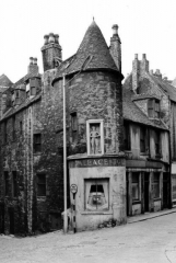
I have been much taken by two illustrated postcards I bought for 10p each in the Ferryhill Library. They depict the long-gone building popularly, if erroneously, known as the Wallace Tower; a once prominent feature of the Netherkirkgate, and are intensely evocative of the old medieval Burgh of Aberdeen, long-predating Union St., King St., Market St., Bridge St., Holburn St. and the later 19th century development of the West End.

The site of Aberdeen has been inhabited since about 6,000 BC. There was a settlement known to the Romans as Devana and identified as such in Ptolemy’s Systems Of Geography of 79 AD. They knew the rivers Dee and Don, which used to conjoin on the Queen’s Links, as the Deva and Devona. Some scholars derive ‘Aberdeen’ from the Pictish-Gaelic aber-devan, meaning ‘at the meeting of two rivers’. It is likely that Roman fleets used the natural harbour at the mouth of the River Dee (Deva) in preparation for their great battle of Mons Graupius against the Caledonians in 83 AD. Thereafter, Aberdeen developed as two settlements: the Royal Burgh of Aberdeen from the mid 12th century which developed around the natural harbour at the mouth of the River Dee and the Episcopal Burgh or Kirk-toun of St. Mary’s from 1498, later the Kirk-toun of Aber-don, which grew up around St Machar’s Cathedral and King’s College and later became known as Old Aberdeen. The two burghs did not become one until 1891.

Trade outside the Burghs was banned. For the residents of a Royal Burgh, the feudal superior was the King himself.

The medieval township was well established as an un-walled trading community by the mid 12th century. Aberdeen was granted the status of a Royal Burgh by King David I (1124-53), with concomitant rights and privileges relating to manufacturing and trade. The effect was that Aberdeen was permitted a degree of autonomy in the conduct of its affairs although it had to conform to the accepted mercantile and burgh law common to England, Scotland and northern France. The trading and other privileges of the older Royal Burgh of Perth were granted to Aberdeen.

It should be realised that markets, fairs etc. could be held only by permission of the landowner or feudal superior. This meant in practice that trade in agricultural and other products could only take place in the fairs and markets of the Burghs which became processing plants for the products of the rural hinterland. Trade outside the Burghs was banned. For the residents of a Royal Burgh, the feudal superior was the King himself. There were none of the usual feudal obligations to any local Earl or lesser landowner but taxes were payable to the Exchequer.

The most powerful of the townsfolk were the burgesses; generally merchants and traders, who had commercial privileges. Only burgesses could own and operate businesses as well as having certain civic responsibilities. Most of the early burgesses came from Flanders, northern France, England and Lothian, bringing with them skills and expertise hitherto lacking in Scotland. They spoke many different tongues, but settled on English as their common language. The burghs became enclaves of English-speakers and their use of English spread outwards to the surrounding hinterlands. In addition, the Royal Burghs, which were almost all east-coast seaports like Aberdeen, Dundee, Perth, Leith and Berwick, had a legal monopoly of trade with foreign countries; in return, the burghs were responsible for the collection of the duties levied on both imported and exported goods and for remitting these revenues, plus sundry rents, fines and tolls, to the Exchequer. The burghs thus became the main source of revenue for the kings of Scotland and, in consequence, the burgesses became men of national significance.

Six members of the Menzies family were Provosts for a total of eighty-three years out of the 16th century alone

Aberdeen’s earliest extant Charter, detailing its privileges, rights and responsibilities, is that granted by William the Lion, grandson of David I, about 1171. In 1211, William the Lion granted his palace in the Green to the Trinity or Red Friars for use as a monastery. The Dominican or Black Friars and the Carmelite or White Friars settled in the same area whilst the Franciscan or Grey Friars had their monastery adjacent to the Broadgate; hence various street and place names still in use in our own time. The Burgh had become an efficient municipal organisation by the 14th century. Its first recorded Provost was Ricardus Cementarius, Richard the Mason, in 1272.

The Burgh had a system of higher and lower courts and a Council drawn from the burgesses of the Merchant Guild of between 12 and 24 members and other officers, sergeants, treasurers etc. In practice, the Council became a self-perpetuating oligarchy dominated by the Menzies family of Pitfodels; successive members of which served as Provosts of Aberdeen for 114 of the 212 years from 1423 to 1635. Six members of the Menzies family were Provosts for a total of eighty-three years out of the 16th century alone including (one such) Thomas Menzies. He served three terms (of) in office – the longest for the period 1547-75 totalling forty years. Aberdeen became something like a European city-state with a single ruling family whose autocracy was, however, subject to the constraint of other burgesses such as the Rutherfords, Chalmers and Cullens.

There was a degree of dictation from the Court and Parliament in Edinburgh and, occasionally, an attempt by neighbouring landowners like the Forbeses, the Gordon’s or the Seton’s to take over the Burgh or to seize some of its possessions. Substantial sums of what amounted to protection money were paid to these families, to keep them at bay.

The Gordons of Huntly were by far the largest and most powerful of the local landowning families and it was to them that the Burgh looked for protection and support. There was a close working relationship between the (burgess) Menzies family and the (aristocratic) Gordons of Huntly to the extent of intermarriage. In 1545, Thomas Menzies resigned as Provost to be succeeded by George Gordon, the 4th Earl of Huntly – the only peer ever to hold that office, albeit for a period of only two years.

But, for most intents and purposes, the Burgh was both independent and autonomous; the more so because of the grant to the Burgh in 1314 by King Robert I (Bruce) of the Royal Forest of Stocket. This became the basis of the Common Good Fund and guaranteed the Burgh a substantial source of revenue such as could finance significant investments and improvements thereafter. Another of the many benefactions from Good King Robert was the Brig o’ Balgownie, built at his order across the River Don in 1320 to facilitate trade with the lands of Buchan, Formartine and the Garioch.

King Robert’s daughter Matilda married Thomas Isaac, the Town Clerk of Aberdeen, and his (Bruce’s) sister Christian latterly lived and died in Aberdeen. These things are indicative of the Bruce’s close relationship with, and affection for, the Burgh of Aberdeen and its citizens.

Jul 232010
 

By Alex Mitchell.

Monday 12th July 2010, warm and sunny. Left the car in the Denburn car park, walked under the Viaduct and into Union Terrace Gardens – the one substantial green space in Aberdeen city centre – beautiful, verdant, quiet, restful, and well-maintained as always by Council Parks and Gardens staff. A fair smattering of people sitting around, including women with children. No drunks. The trees all seem in good health, despite ACSEF propaganda. Up on to Union Street. The awful, tacky Sports Direct shop frontage – formerly Zavvi, before that the Virgin Megastore – is still in evidence, months after we were assured by the Planning Department that it would be dealt with. Continue reading »

Jul 092010
 

by Alex Mitchell.

I first became aware of Carmina – I never learned her last name – when we were both students at the University of Aberdeen. She was a dark-haired, exotic beauty at the centre of a group of decadent, upper-class sophisticates who seldom bothered to turn up at lectures but would come lurching into tutorials, at which attendance was compulsory, still half-wrecked from the excesses of the previous night or weekend.  Continue reading »

Jul 022010
 

By Alex Mitchell

After a little consideration of the inescapable fundamental features of the City Square/ Gardens Project, some construction engineering issues arise.

Surely there would be significant challenges to be overcome after creating a 3-4 storey steel & concrete building in a deep hole in the ground that would have once been our Victorian Union Terrace Gardens. A river valley, a natural drainage sump, topped off by a vast (5-acre) and largely flat concrete expanse – where would the rainwater go? A situation further exacerbated when businesses, shops and restaurants would be operating in the ‘concourse’ directly below.

Continue reading »